Discover The Latest Technology Used In Private Utility Locating In Mesa

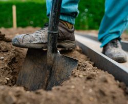
Utility locating is a crucial process that helps to identify and map the location of underground utilities before any excavation work can take place. The process involves the use of advanced technology and equipment to ensure that the work is done accurately and safely. In recent years, there have been significant advancements in locating technology, making the process faster, more efficient, and cost-effective. This article explores some of the latest technology used in Private Utility Locating in Mesa and their benefits.
Ground Penetrating Radar (GPR)
Ground penetrating radar cokes as a non-destructive technology that utilizes electromagnetic radiation to identify and locate subsurface utilities. It operates by transmitting high-frequency radio waves underground and scrutinizing the reflected signals. We heavily use GPR technology in identifying the site and depth of underground utilities, such as water pipes, sewer lines, and electrical conduits. The technology can be used in different types of soil, including clay, sand, and rock. It helps us to create 3D maps of undersurface utilities, making it easier to plan and execute our excavation work.
Electromagnetic Induction (EMI)
Electromagnetic induction technology is a non-invasive method that enables us to detect underground utilities. The technology works by emitting an electromagnetic field and measuring the resulting energy. The energy changes when it encounters undersurface utilities, allowing our experts to locate the site and depth of these utilities. Mesa, AZ private utility locating contractors depend on this innovation when detecting metallic objects, such as pipes and cables. However, it is less effective in detecting non-metallic materials such as plastic pipes. The technology is quick and easy to use, making it a common application in our operations.
Acoustic Pipe Locators
We use acoustic pipe locators that depend on sound waves to locate underground pipes. This technology works by inserting a device into the pipe and emitting a high-frequency sound wave. The device then listens for the sound wave’s reflection which allows us to identify the location of the pipes. We use these locators when locating pipes made of different materials, including metal, PVC, and concrete. The innovation is also effective in detecting leaks in pipes, making it useful for maintenance and repair work.
Geographic Information System (GIS)
Geographic Information System (GIS) is a mapping technology that allows us to integrate different data sources. The integration enables us, our experts, to create a comprehensive view of the location and characteristics of underground utilities. GIS can integrate data from different sources, including utility identification, satellite imagery, and geological surveys, to create a detailed map of undersurface utilities. The technology can also be used when managing infrastructure projects, such as water supply and waste management systems. Ensure you call before you dig to get accurate data that can be used for planning and execution of excavation work.